
Arrive on scene faster than ever before
When every minute counts, inaccurate or incomplete geospatial data is unacceptable. That’s why we take emergency personnel within 10 feet of their destination.
Quickly locate obscure addresses, like apartment units or college dorms, through a series of coherent waypoints. Pins reveal entrances, private roads, entryways, elevators, stairs, unit numbers, knox boxes, hydrant locations, shutoff valves and other crucial points of interest.
Key Benefits
Fill in missing gaps of data on your current navigation software with our API
Significantly reduce response times
Direct responders straight to the correct doorstep with waypoints
Eliminate navigational confusion to keep responders calm and focused upon arrival

Premium data
Micro-route responders straight to complex points of interest
Provide the missing data first responders need in order to cut down critical minutes. Direct emergency personnel straight to knox boxes, stairways, hydrants, unit numbers, and other pivotal locations with pinpoint accuracy. Our data easily integrates into any first responder system: 911 System, CAD, Incident Response System, Emergency Alert System, and more.
Helps reduce emergency response time to save critical minutes.
Direct first responders to the correct entrance where incident has occured
Eliminates having to go through a series of sequential waypoints
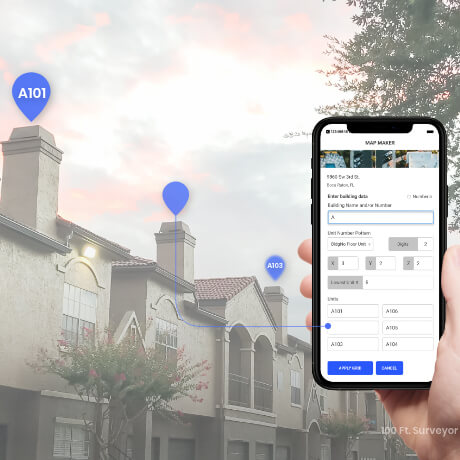
Map Maker
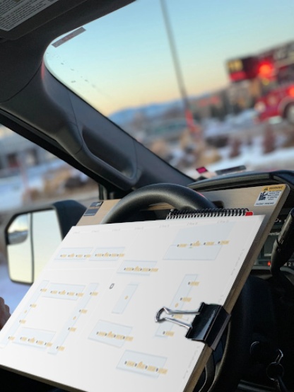
Generate accurate pre-plans with speed and precision
Across the US, first responders trust Map Maker, an advanced GIS tool with micro-tagging capabilities, to draw and maintain their incident pre-plans. Map Maker empowers responders to create digital data to mark the precise locations of unit numbers, fire hydrants, knox boxes, shut-off valves, handicapped entrances, and other points of interest. Map Maker allows responders to:
Enter data on your smartphone or tablet
Share mapped data to entire department
Access digital pre-plans en route or on the scene
API Integration
Add pinpoint location data to your current GPS system
Our data can be added onto any First Responder dispatching solution, like CAD and 911 System. Within days, our data can be integrated into your system through simple API. The integration details previously unmapped locations, like apartment units and specific areas within nursing homes.